AeroIntel AI: Analytical software solution for UAV
A government defense agency approached WEZOM to automate the analysis of aerial reconnaissance images. Manual identification of strategic objects took days and limited decision-making speed. The goal was to build an AI-powered solution to detect and classify key military and infrastructure objects in satellite and drone imagery.
Objective
Develop a high-performance object detection system using computer vision to analyze large datasets, reduce manual labor, and enable near real-time classification of critical objects like aircraft, refineries, ports, and military vehicles.
Our Approach
-
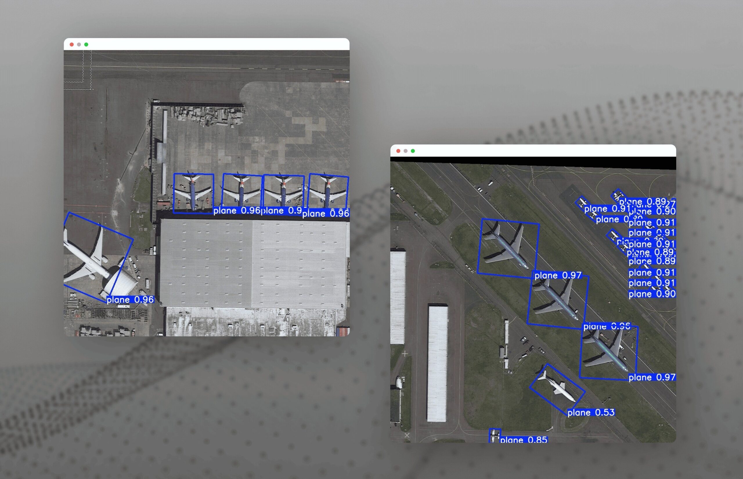
Model Architecture: Built on YOLOv8 and PyTorch, with transfer learning using the DOTA dataset for remote sensing. We adapted the model for specific target classes and enabled support for oriented bounding boxes (OBB) to recognize objects at angles.
-
Processing Pipeline: Implemented batch inference with FastAPI for real-time access. OpenCV handled image preprocessing and visualization, while results were stored in PostgreSQL and formatted in JSON for integration with GIS and dashboards.
-
Accuracy & Speed: The model achieved mAP@0.5 = 80%, precision = 0.82, and recall = 0.80. Inference speed was ~0.3s per image, allowing scalable analysis of thousands of images with over 200,000 labeled objects.
Results
The solution automated aerial image analysis, minimized human error, and allowed integration with defense and intelligence systems. It supports active learning, is ready for new object classes, and can be scaled to GPU clusters for high-volume processing.
Next Steps
Ongoing work includes active learning integration, GIS platform connectivity, and expansion of object categories to adapt to dynamic reconnaissance needs in both civilian and military scenarios.
Don’t want to miss anything?
Subscribe to keep your fingers on the tech pulse. Get weekly updates on the newest stories, case studies and tips right in your mailbox.

